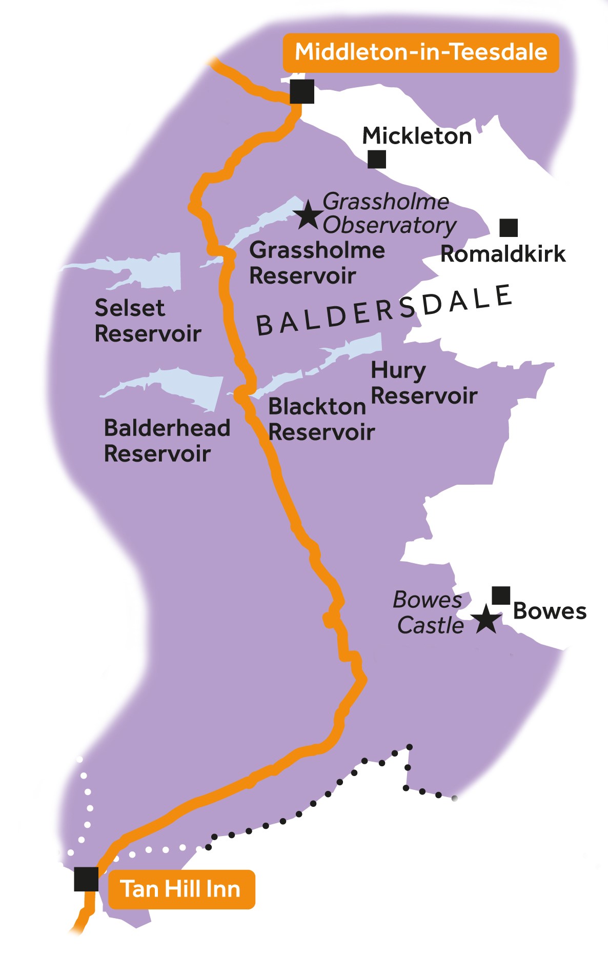
Leg 12Middleton-in-Teesdale to Tan Hill Inn

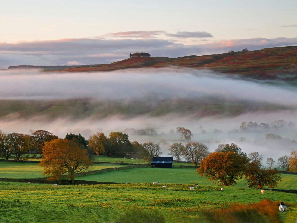
Leg 12 of the multi-day Roof of England Walk – a journey around the North Pennines. Follow the Pennine Way on its southerly journey crossing the remote Lunedale, Baldersdale and across the wide-open moors all the way to Tan Hill. Linear route – 26.5km.

God’s Bridge

The journey south continues past God’s Bridge, a rare natural limestone bridge over the River Greta, ultimately bringing you to Trough Heads. Here the route swings round to the southwest, traversing the renowned bogs of Sleightholme Moor. The day finishes at Tan Hill Inn, Britain’s highest public house.

The Bowes Loop is an alternative route taking you from Blackton Reservoir to the village of Bowes then back to re-join the main Pennine Way route at Trough Heads.

Roof of England Walk

Leg 12 of the Roof of England Walk shares the route of the Pennine Way National Trail between Middleton-in-Teesdale (NY 94610 25144 and ///stood.gent.lucky) and Tan Hill Inn (NY 89704 06682 and ///span.active.slant). To follow this leg and the Roof of England Walk you will need to be able to map read/use a compass.

Turn-by-turn directions for this leg (including maps) are available as a pdf download. You can also download a GPX file to use on your own device (phone, watch or handheld).

Terrain

Gentle rolling moorland with wet, boggy sections to negotiate. Windswept sections where navigation could be tricky in misty weather, although there’s often a stone wall or fence to follow. Field paths and stone tracks and short road sections.

Starts at 220m with a high point of 526m (at Tan Hill Inn). Over the day there is 804m of climb. Make sure you take a paper map with you (at least as a backup). Leg 12 is covered by the following OS Maps: Explorer – OL31 and OL30; and Landranger – 92 .

Responsible visiting

Please make sure you follow the Countryside Code (Respect, Protect, Enjoy – www.countryside-code.org.uk) and behave responsibly whist enjoying the Roof of England Walk.

Points of interest

1

Start

Start of Roof of England Walk Leg 12 – Middleton-in-Teesdale to Tan Hill Inn.

2

The Pennine Way

Leg 12 of the Roof of England Walk route coincides with the Pennine Way National Trail. The trail starts in Edale, in the Peak District, and finishes 431km (268 miles) later at Kirk Yetholm, in the Scottish Borders. A quarter of the route is within the North Pennines National Landscape. The Pennine Way is Britain’s first national trail and in 2025 marked its 60th anniversary.

3

View of Middleton-in-Teesdale

If you pause and take a look behind you there is a good view of Middleton-in-Teesdale. Middleton was an important centre for the North Pennines’ lead mining industry. It was developed by the London Lead Company. Lead mining dominated employment between the 1700s and 1900s. At its height, 90% of Middleton’s employed people were directly involved in mining.

4

Kirkcarrion

When you reach the cairn look to your left and notice the wooded hill top, known as Kirkcarrion. It is a local landmark in Upper Teesdale. The origin of the name is believed to be from Carreg Caryn, which translates to ‘Caryn’s burial mound’. It dates to the Bronze Age and the trees contain a burial site.

5

Lunedale view

As you cross the line of a tumbled down wall you will be greeted by spectacular views of Lunedale. The River Lune flows through the dale stretched out in front of you before it joins the River Tees. The flow of the river is broken by the two reservoirs of Selset and Grassholme. Broadly parallel to Lunedale, and to the south, is the remote Baldersdale.

6

Wythes Hill tuck shop

The honesty box tuck shop at Wythes Hill Farm is one of several along the length of the Pennine Way. Whilst not to be relied upon, they can be a welcome treat for weary walkers who bring cash. It is also possible to fill up with water at the farm using an outside tap.

7

Grassholme Reservoir

Notice the small picnic site at the end of Grassholme Reservoir. There’s a great view and also a circular walk around the water, although you’re unlikely to have spare energy for it today. The reservoir is owned and run by Northumbrian Water and is one of the top ‘any method’ fisheries in the country.

8

Grassholme Observatory

If you turn left here and walk for 2.3km along the southern side of the reservoir, you will reach a small visitor centre and the Grassholme Observatory. The North Pennines is the darkest mainland National Landscape and is a great place for stargazing.

9

Hannah's Meadow nature reserve

Hannah’s Meadow is a Site of Special Scientific Interest (SSSI) and is owned and managed by Durham Wildlife Trust. The meadow is best visited in June and early July to see traditional hay meadow flowers, such as ragged robin, wood crane’s-bill, marsh marigold, yellow hay-rattle, and globe flower. Visit the barn which houses some interpretation boards to find out more.

10

Low Birk Hatt

The original owner of the hay meadow you’ve just walked through, Hannah Hauxwell, lived alone at this farmhouse without the luxury of electricity and running water. She found fame in a 1973 ITV documentary ‘Too Long A Winter’. When she retired in 1988, her smallholding became a nature reserve. The house is private, please don’t try and visit.

11

Blackton Reservoir

A range of wildfowl can bee spotted on Blackton Reservoir, including mallard, teal, tufted duck, wigeon and goosander. Look out for moorhen, heron and reed buntings around the margins of the water. As you cross the bridge at the end of the water and climb up the track towards Clove Lodge keep an eye out for buzzards soaring overhead.

12

The Bowes Loop

If you have decided to follow the alternative Bowes Loop this is where you will strike out east to pass closer to the south of Goldsborough.

13

Goldsborough

If you glance to your left (northeast) you will spot the prominent crags of Goldsborough, about a mile away. This flat-topped hill is made up of gritty sandstones. These hard rocks formed in vast, ancient deltas some 300 million years ago. To you right is its ‘sister’ Shacklesborough – but this hill is 3km distant so harder to spot.

14

God's Bridge

Your route crosses this remarkable natural bridge in the Great Limestone – spanning the River Greta. It is probably the relic of a collapsed valley floor cave system.

15

The Bowes Loop

The Bowes Loop re-joins the main Pennine Way route here.

16

Sleightholme Moor

Sleightholme Moor is perhaps one of the most windswept, bleakest places on the Pennine Way and certainly on the Roof of England Walk. You will be lucky to escape its clutches without getting wet feet. Apparently Alfred Wainwright described it as a ‘journey of despair’. But fear not because at the end of it you will get a warm welcome at the Tan Hill Inn.

17

Tan Hill Inn

The Tan Hill Inn is Britain’s highest pub. The building dates to the 17th century and it was used as a hostelry by working digging coal pits. Nearby miners’ cottages formed its clientele, as well as farmers, pedlars and cattle drovers. The last mine closed in 1929 and the cottages were demolished in the 1930s but local farmers and the development of tourism/the car saved the inn.

18

Finish

Finish of Roof of England Walk Leg 12 – Middleton-in-Teesdale to Tan Hill Inn.

Introduction
01