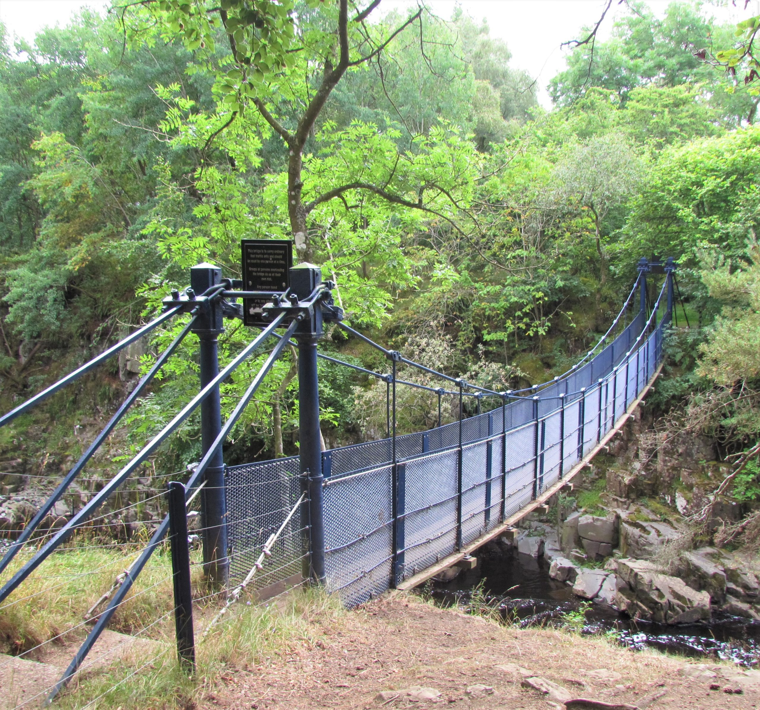
Leg 11Saur Hill Bridge to Middleton-in-Teesdale

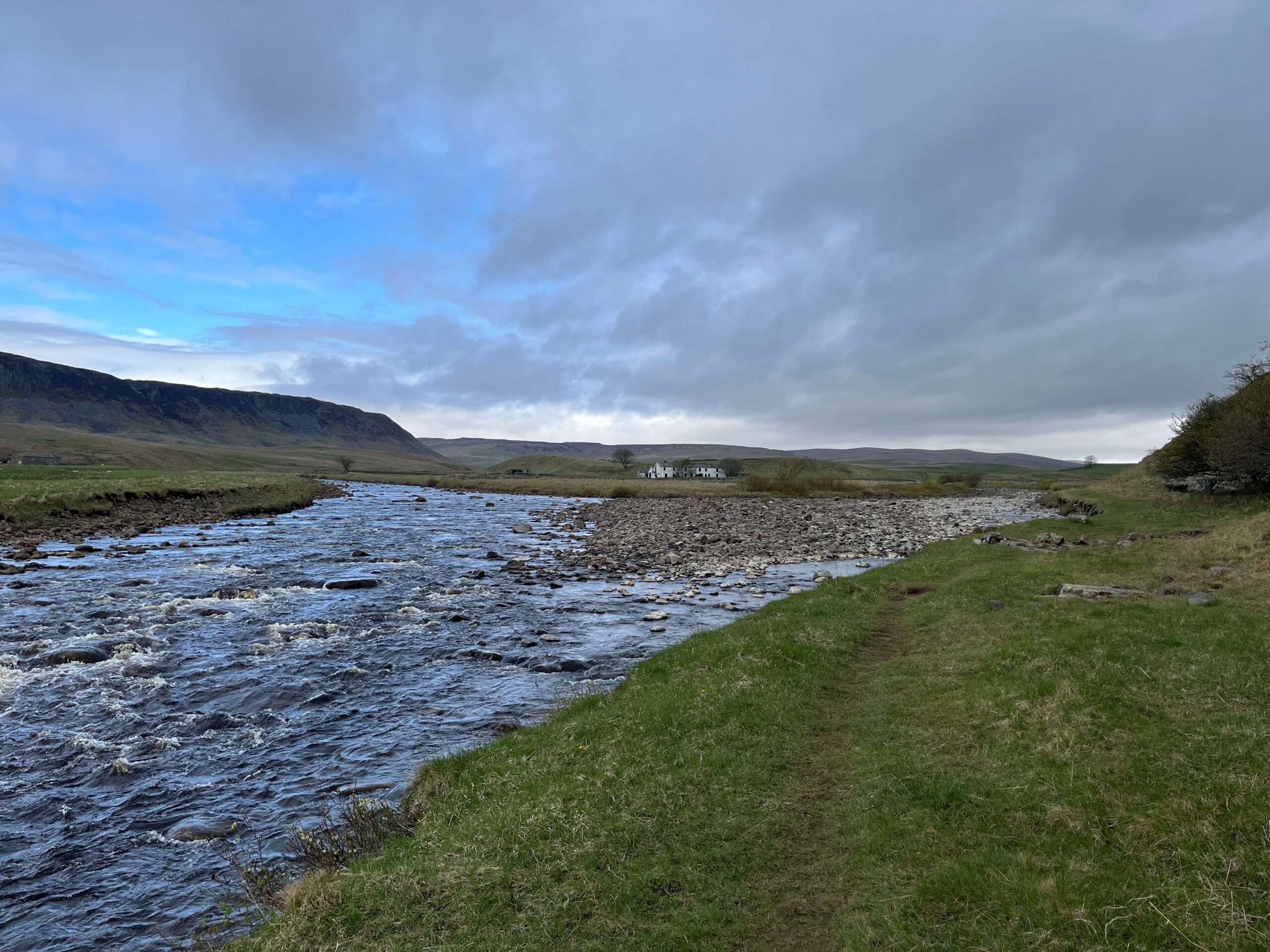
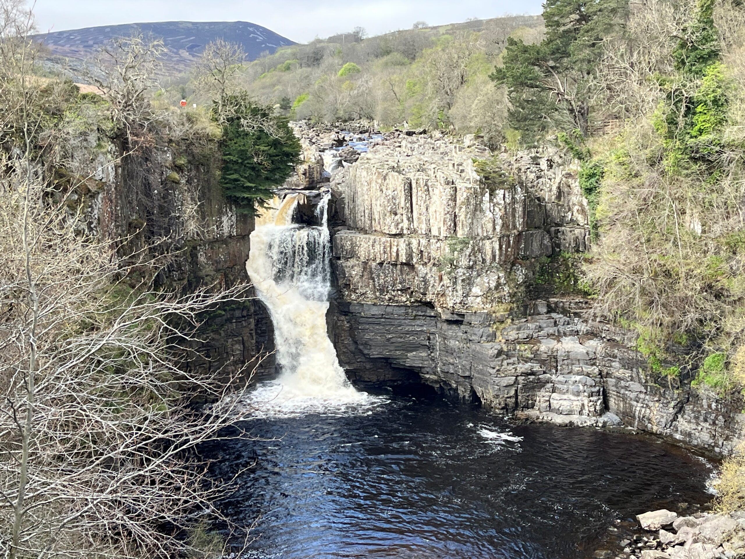
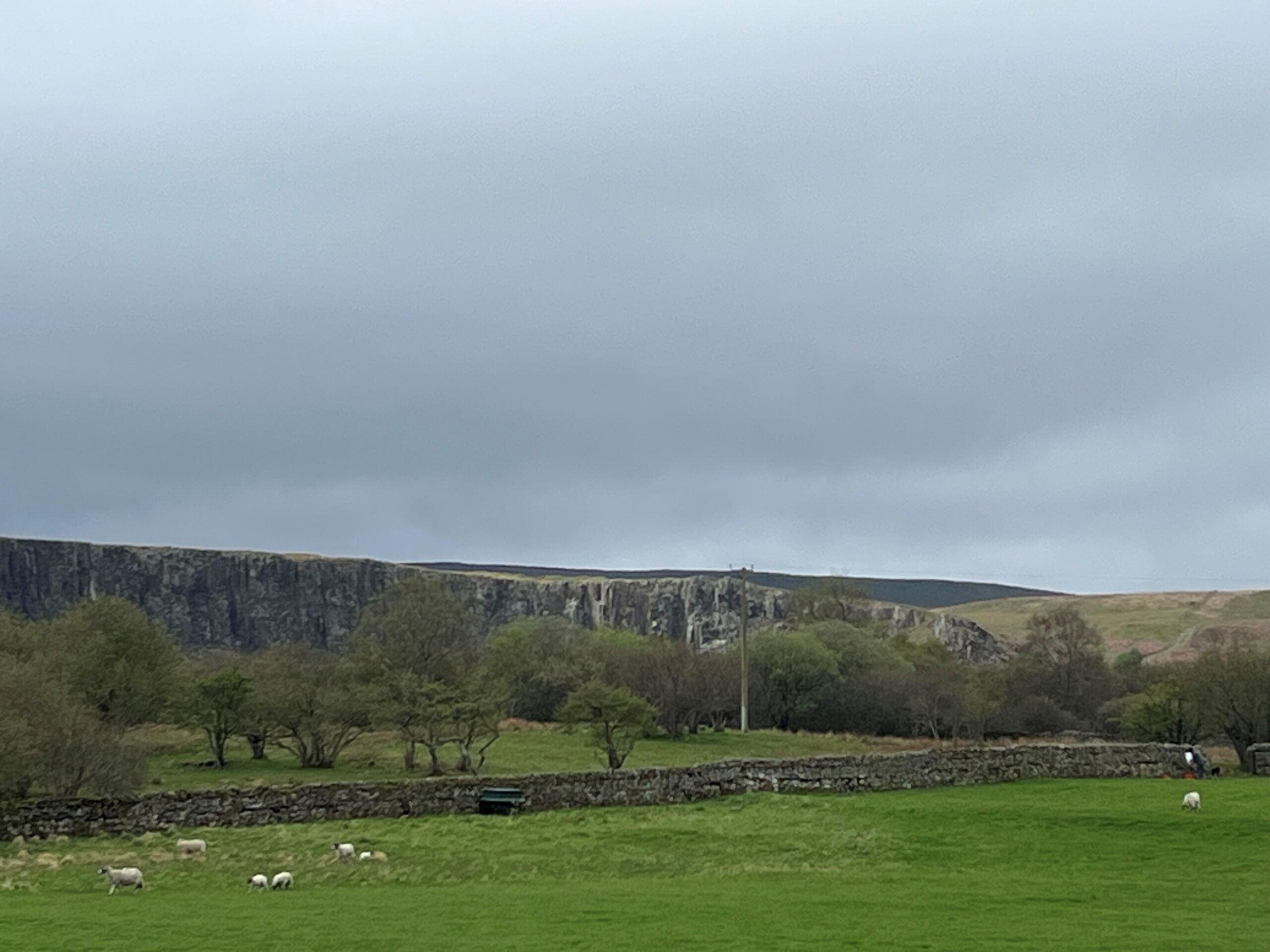
Leg 11 of the multi-day Roof of England Walk – a journey around the North Pennines. A relatively short, gentle day following the flow of the River Tees to Middleton – the ‘capital’ of Upper Teesdale. Linear route - 12.5km.

High Force

Appreciate the drama of England’s biggest waterfall, High Force, and its smaller sibling Low Force. Experience the England’s largest juniper woodland and pass through Moor House -Upper Teesdale National Nature Reserve.

Bowlees Visitor Centre

From Low Force there is the option to divert off route (0.5km) to go to Bowlees Visitor Centre – gateway centre to the North Pennines National Landscape and UNESCO Global Geopark, café, toilets and information.

Roof of England Walk

Leg 11 of the Roof of England Walk shares the route of the Pennine Way National Trail between Saur Hill Bridge (NY 85476 30211 and ///regard.receiving.hangs) and Middleton-in-Teesdale (NY 94610 25144 and ///stood.gent.lucky). To follow this leg and the Roof of England Walk you will need to be able to map read/use a compass.

Turn-by-turn directions for this leg (including maps) are available as a pdf download. You can also download a GPX file to use on your own device (phone, watch or handheld).

Terrain

Rough, muddy and rocky riverside paths and grassy paths across fields. Lots of wooden and stone step stiles and gates. Crushed stone paths, boardwalks and sections of stone flags. Starts at 365m with a high point of 394m. Over the day there is only 104m of climb. Please make sure you take a paper map with you (at least as a backup). Leg 11 is covered by the following OS Maps: Explorer – OL31; and Landranger – 92.

Responsible visiting

Please make sure you follow the Countryside Code (Respect, Protect, Enjoy – www.countryside-code.org.uk) and behave responsibly whist enjoying the Roof of England Walk.

Points of interest

1

Start

Start of Roof of England Walk Leg 11 – Saur Hill Bridge to Middleton-in-Teesdale.

2

View of Cronkley Scar

If you look across the Harwood Beck to the southwest you will see the crags of Cronkley Scar. This dramatic feature in Upper Teesdale is made out of whinstone (a form of dolerite). It formed 295 million years ago when molten rock solidified underground. After millions of years of erosion it is now exposed at the surface.

3

Whitewashed

Notice that Wheysike House, on the other side of the Harwood Beck, is whitewashed. This indicates that it is part of Raby Estate, owned by Lord Barnard of Raby Castle. Legend records that a former Duke of Cleveland was refused shelter in a Teesdale farmhouse, which he thought he owned. Feeling humiliated he decided that all of his buildings should be painted white to allow easy identification.

4

Spring gentians

Between April and early June you might see these small (15-30mm across), deep-blue flowers on this bank beside the Harwood Beck. Best seen on warm, bright days, look out for a delicate plant with a solitary, intense-blue flower, like a tiny, five-pointed star. It is a striking symbol of Teesdale and is found in only a few other places in Great Britain, such as the Burren in Western Ireland.

5

Confluence

Notice that the Harwood Beck/Langdon Beck joins forces with the River Tees here. Just over 80 miles (130km) later the rushing water you see here reaches the North Sea at Tees Mouth, Middlesbrough.

6

Moor House-Upper Teesdale National Nature Reserve

As you cross over the Tees you are entering one of the largest National Nature Reserves in England. Moor House-Upper Teesdale is famous for its unique Arctic-Alpine plants which have survived in this part of northern England since the last Ice Age. The reserve encompasses an almost complete range of typical upland habitats typical of the North Pennines – from hay meadows to summit heaths.

7

Juniper wood

As you reach the top of the short, rocky, climb notice the prickly, evergreen shrubs. You have entered England’s largest juniper wood. Some of the bushes are pretty vintage, over 250 years old. This wood is a relic of the woods that grew here after the ice age ended around 15,000 years ago. Berries on the bushes provide welcome food for mice, voles and migrating birds like fieldfares.

8

Force Garth Quarry

Force Garth Quarry opened in 1932 and is the sole remaining whinstone (dolerite) quarry in the North Pennines. The quarry produces between 250,000 and 300,000 tonnes a year.

9

Bleabeck Force

If you glance to your right as you cross the footbridge opposite Force Garth Quarry you will see the waters of the Blea Beck tumbling over Bleabeck Force.

10

Top of High Force

Take care as you approach the top of High Force – one of the most impressive waterfalls in England. Be aware of natural hazards, sheer drops, slippery rocks and fast-flowing water. High Force is considered to be the biggest waterfall in England - by volume of water dropping 21m over the Whin Sill lip. J.M.W Turner painted it in 1822 and people are still drawn to witness its sheer power.

11

High Force viewpoint

High Force plunges over the Whin Sill – a hard dolerite rock. Below the Whin Sill you can see layers of sandstone and limestone, part of the sequence of rocks that make up most of the North Pennine landscape. ‘Force’ comes from ‘foss’, the Old Norse word for waterfall.

12

Coldberry Gutter

The v-shaped notch on the skyline is called Coldberry Gutter. This huge landscape feature was probably first cut by flowing water as glaciers melted at the end of the last ice age. A lead vein also runs through it which was worked by miners from at least the mid-18th century.

13

Dippers

Keep your eyes open as you walk along this stretch of the river as you are quite likely to see dippers. Look for a compact, short-tailed, bird with a characteristic whirring flight. When it perches on rocks it tends to bob up and down, with its tail sticking up. Its white breast contrasts with darker body plumage. They dive in and out of the rapids hunting insect larvae and freshwater shrimps.

14

Low Force

Low Force tumbles over the Whin Sill, a layer of hard rock called dolerite, known locally as whinstone. The Whin Sill formed 295 million years ago, when molten rock rose up from within the Earth and spread out between layers of limestone, sandstone and shale. The molten rock cooled and hardened underground. Millions of years of erosion have exposed the Whin Sill at the surface here at Low Force.

15

Wynch Bridge

The Wynch Bridge was originally built, in 1741, so that lead miners from Holwick could cross the river to work in mines on the north side of Teesdale. In August 1802, as a party of haymakers was crossing, one of the chains snapped; three men fell into the river and one drowned. It was repaired, but in 1830 it was replaced by the present bridge.

16

Low Force bluebells

The best displays of bluebells, near Low Force, are found here. If you’re walking in late April or early May you are likely to see them at their best. Please stick to the path – bluebells can take many years to recover from being trampled. Because they flower earlier than many other plants they are very beneficial to bees, butterflies and hoverflies which all feed of their nectar.

17

Mine entrances

In the fields on your right there are two gated mine entrances with small spoil heaps. These are old trial mines which explored some minor mineral veins. The miners were originally looking for lead ore, but there is very little in the veins here. The veins are, however, rich in zinc and iron ores. Unfortunately the deposits were not large enough to be worked economically.

18

Crinoids at Scoberry Bridge

Cross the bridge over the Tees and have a look for fossils in the flat Cockleshell Limestone outcrop by the river. The picture is a cross section of a crinoid stem. Crinoids were anchored to the sea floor and swayed in the currents, catching particles of food with bony arms. They are common fossils in North Pennine limestones. Tip: splash some water on the fossils to make them stand out.

19

Hay meadows

In early summer hay meadows like this one are full of colourful wild flowers like yellow rattle, meadow buttercup and red clover. The North Pennines has over 40% of the UK’s upland hay meadows, which survive because many farmers practise traditional low-intensity farming methods.

20

Crossthwaite Quarry

The quarry you can see from here is a disused whinstone quarry called Crossthwaite Quarry. It is one of two old quarries off the road between Middleton and Holwick. In the 1920s it employed nearly 150 men. The whinstone was used to make ‘setts’ i.e. brick-shaped blocks used to cobble roads. It was ideal for this use because whinstone is a very hard rock.

21

Bluebells

When the bluebells bloom in late April-early May you can be confident that spring is in full flow in the North Pennines. This section, with fringes of woodland, is an especially good for a bluebell display. Bluebells are associated with ancient woodland – so if you see them it is possible that there’s been woodland thereabouts since 1600.

22

Ash trees

Ash trees are very prominent in the Teesdale landscape – often occurring as field trees. As the fungal disease, ash dieback, spreads it is likely that the visual character of the dale will change. However, it is thought that 1-5% of trees may show reasonable tolerance of the disease – so there is hope that this iconic English tree species could eventually recover.

23

Finish

Finish of Roof of England Walk Leg 11 – Saur Hill Bridge to Middleton-in-Teesdale.

Introduction
01