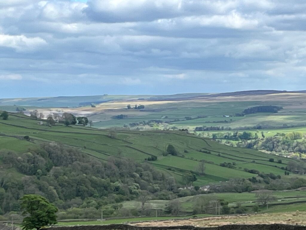
Leg 9Stanhope to St. John’s Chapel

Leg 9 of the multi-day Roof of England Walk – a journey around the North Pennines. A varied day exploring Weardale, getting to grips with its mining and industrial past. Riverside trails and open ground with stunning views. Linear route – 18.5km.

River Wear

After a stretch alongside the River Wear, the route heads north up the Rookhope Valley at Eastgate. Eastgate marks the eastern boundary of the old Stanhope Deer Park where the Prince Bishops held their famous ‘Great Chases’. Historic lead mining sites in the Middlehope Valley lead you back down to Westgate. Riverside walking brings you to the outskirts of St. John’s Chapel.

Roof of England Walk

Leg 9 of the Roof of England Walk largely follows the route of the Weardale Way between Stanhope (NY 99349 39159 and ///plugged.defeated.corrosive) and St. John’s Chapel (NY 88843 38119 and ///rewarding.influence.thus). To follow this leg, and the Roof of England Walk, you will need to be able to map read/use a compass.

Turn-by-turn directions for this leg (including maps) are available as a pdf download. You can also download a GPX file to use on your own device (phone, watch or handheld).

Terrain

Rough, muddy and rocky riverside paths and grassy, boggy paths across fields. There are a number of stiles, including ladder stile, to cross. Some stone tracks and tarmac sections. Pathless terrain, over rough tussocky ground, for 1.5km across Weather Hill.

Starts at 297m with a high point of 448m. Over the day there is 387m of climb. Please make sure you take a paper map with you (at least as a backup). Leg 9 is covered by the following OS Maps: OL31 and 307; and Landranger – 92 and 87.

Responsible visiting

Please make sure you follow the Countryside Code (Respect, Protect, Enjoy – www.countryside-code.org.uk) and behave responsibly whist enjoying the Roof of England Walk.

Points of interest

1

Start

Start of Roof of England Walk Leg 9 - Stanhope to St. John's Chapel.

2

Stanhope show field

The large field to the left of the route is the show field. The Stanhope Agricultural Show is always held on the second weekend of September. It was founded in 1834 and is one of the oldest traditional agricultural shows in the country.

3

Stanhope stepping stones

The ford and stepping stones across the Wear at Stanhope are a popular destination for families on sunny summer days. If you are lucky, there will be an ice-cream van parked nearby. On Stanhope show weekend in September, the Stanhope Silver Band parade through the settlement before crossing the stones and officially opening the show.

4

Stanhope Bridge

Stanhope Bridge is a listed as a Scheduled Ancient Monument - Grade II* - by Historic England. It is originally Medieval with early 19th and 20th century restorations.

5

Greenfoot Quarry

Greenfoot Quarry is a designated Site of Special Scientific Interest (SSSI) indicating that it is of national geological importance for its exposures of the Little Whin Sill. At the western end of the quarry there is a unique exposure which displays columnar jointing in the sill with limestone exposed above and below the intrusion.

6

Stanhope Gauging Station

The gauging station opened in 1958 and since then it has monitored river levels to help with flood warnings on the Wear. In 2018 the Environment Agency installed a Larinier fish pass which allows more species of fish to pass upstream in a much wider range of river levels, improving access to around 15 miles of spawning grounds.

7

Weardale Railway

Here the route closely follows the route of the Weardale Railway. This section was part of the line which originally ran the 25 miles from Bishop Auckland to Wearhead. It was started as an offshoot of the Stockton & Darlington Railway in 1847 to transport material to the ironworks of Teesside and, by 1895, it had been extended along the dale as far as Wearhead.

8

Eastgate

Eastgate originally marked the eastern boundary of Stanhope Deer Park, the private hunting park of the Prince Bishops of Durham. The famous 'Great Chases' were held here. In its heyday the park’s boundary was 14 miles long, making it the second largest in the country after the New Forest.

9

Eastgate Roman Altar

Just to the left of the bus shelter in Eastgate you will find a replica of a Roman altar. The original was found nearby on the east bank of the Rookhope Burn. It is a 2nd or 3rd century Roman altar dedicated to Sylvanus, the god of hunting and the woods. The original is now in the Department of Archaeology at Durham University and the replica was placed here in 1969.

10

Wild garlic

In springtime (from early May) you will encounter drifts of wild garlic in these woods. If you rub a leaf between your fingers you will release a strong aroma of garlic.

11

Hazel coppice

Look to your left and notice the many-stemmed tree. This is a hazel coppice stool, indicating that this wood has been managed in the past using coppicing. Coppicing is a technique where hazel trees are repeatedly cut back to the base (creating a ‘stool’) to encourage new growth and a sustainable supply of timber and other products like hazel poles.

12

Primroses

There’s an impressive display of primroses on Ambling Gate Bank in late April to early May. As one of the first woodland flowers to bloom they provide important early season nectar for butterflies and bumblebees. Primroses can be an indicator of the presence of ancient woodland so they could be a sign that you're standing in a rare habitat.

13

The Rookhope Burn

The stream bed of the Rookhope Burn is made up of regular blocks of rock. This is a layer known as the Four Fathom Limestone, named for its thickness by past quarrymen and miners. A fathom is equivalent to 6ft or 1.83m.

14

Brandon Walls Lead Mine

Brandon Walls Mine was first recorded in 1662, but most of the features visible today date from the 19th century. The building in the picture might have been the smithy. In the 1870s the mine’s potential was rather exaggerated, attracting large amounts of money from unsuspecting investors. It was never as productive as other mines further up the valley and it finally closed in the 1880s.

15

Thorny Brow Mine

This small mine was leased by Robert Jopling in 1801. The mine yielded 257 tons of lead ore between 1836 and 1842. You can see the concrete-capped mine shaft and a circular grassy area. This is the remains of a horse gin, where horses walked round and round to turn a big wooden drum. This had ropes to raise and lower a large iron bucket. The stony depression is the remains of a wheel pit.

16

Rookhope and Middlehope Railway

As you reach the top of the climb you will turn left onto the old Rookhope & Middlehope Railway which was built to connect Rookhope with mine workings at Middlehope in Weardale.

17

The Elephant Trees

As you approach the abandoned farmstead at High Bishopseat glance to your left and notice the outline of the ‘Elephant Trees’ on the distant skyline, some 12km away as the crow flies. You passed this distinctive Weardale landmark yesterday on leg 8.

18

Curlews

If you are crossing Weather Hill in early summer (May/June), listen out for the rich bubbling song of the curlew. Up and to the right of the route there are large enclosed grass allotments and pastures which serve as ideal breeding grounds for the curlew, Europe’s largest wading bird. You may see them soaring around, easily recognised by a large, downward curved beak.

19

West Rigg Opencut

West Rigg Opencut is a disused ironstone quarry where large iron ore deposits in the Great Limestone, adjacent to the Slitt Vein, were worked. Slitt Vein, which here consists mainly of quartz and a little fluorite, is the prominent wide rib of rock in the centre of the quarry. In the centre you can see narrow slits from which earlier miners attempted to work lead ore.

20

West Slitt Dam

Notice West Slitt dam perched high above the Slitt Mine on the opposite side of the Middlehope Valley. The reservoir was built in 1861 to hold a water supply for the new hydraulic engine at Slitt Mine. A covered watercourse brought water from streams and watercourses several miles further up Weardale into the dam, from where it was carried down the hill in a cast iron pipe.

21

Allotments

Until about 200 years ago all the land around you was a wide sweep of moorland. The Enclosure Acts divided the area into fields with farmers being gifted land. They had to build their own walls to enclose their fields (or allotments) and were then free to improve them. A network of new tracks, giving access to the fields, was also developed. You are walking along one of these enclosure roads.

22

The Middlehope Valley

The Middlehope Valley and Slitt Wood are protected as a Site of Special Scientific Interest (SSSI). The area is designated for its variety of habitats including woodland, lime-rich grassland, fen, open water and the revegetated workings of Slitt and MIddlehope Mine. Many of the industrial remains are also legally protected as Scheduled Ancient Monuments.

23

White's Level

The entrance to the lead mine, White’s Level. This entrance is typical of those found in the North Pennines. It gave access to several veins in what was a reasonably prosperous mine. Driving levels involved the removal to the surface of large amounts of rock, so it was necessary to keep the tunnels to the minimum size practical, usually just high enough for the ponies used for haulage.

24

Mining reservoirs

Here you can see what originally were reservoirs. When White’s Level closed in the 1860s, a dam was built in the mine, so the whole mine became a reservoir supplying water to the Middlehope Shield waterwalls. As the old reservoirs silt up they are becoming valuable wildlife and plant habitats.

25

Middlehope Shield washing floor

What you see here is what remains of the washing floor. More than half of it has been eroded away by the Middlehope Burn. It was here that lead ore was separated from the useless material it was attached to. Much of this work was done by children. It was linked at different times by three different tramways to other mines in the valley.

26

Low Slitt Lead Mine

In its heyday over a hundred people worked here. WB Lead developed Low Slitt from the early 18th century. They drove a level into the hillside and sank a deep shaft. It became one of the biggest lead mines in the North Pennines. Over its lifetime about 100,000 tons of lead ore was won from here.

27

Low Slitt washing floor

The flat area in front of you beside the Middlehope Burn is the old washing floor. It still has very little growing on it. However, areas like this are special for the lead tolerant plants which they support. Spring sandwort is one such metallophyte, easily recognisable in spring/early summer by its star-like white flowers on bright green mossy leaves.

28

Bouseteems

The stone structures in front of you are the remains of two sets of bouseteems. Here the partnerships of miners stored their bouse (unprocessed ore from the mine) until it went through the washing process to separate out the lead ore. As each partnership was paid not for the amount mined but for its lead ore content it was important to store each partnership’s bouse separately before washing.

29

Five Yard Limestone

Here the Five Yard Limestone forms a series of low waterfalls. Notice the way the limestone typically breaks into large almost square blocks along vertical joints in the rock. The river is gradually eroding the limestone along these joints, leaving large broken pieces in the stream.

30

Westgate

The village of Westgate developed just inside the west gate of Stanhope Deer Park. The Prince Bishops of Durham enjoyed hunting and, as the population of Weardale began to expand, settlement, mining and farming began to compete with hunting. To retain some of their hunting grounds, Bishop Robert of Lindisfarne, and later Bishop Anthony Bek, created a fallow deer part.

31

Finish

Finish of Roof of England Walk Leg 9 - Stanhope to St. John's Chapel.

Introduction
01